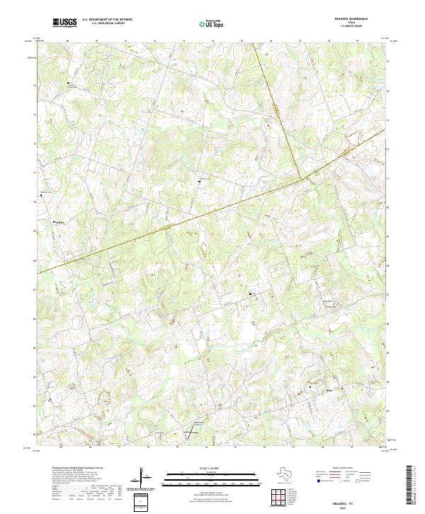
2022 Map of Beaukiss
USGS Topo · Published 2022About this map
The rural landscape of eastern Central Texas at the junction of Lee, Milam, and Williamson counties is defined by the winding tributaries of the Middle Yegua Cr. The small community of Beaukiss serves as a central landmark in an area otherwise characterized by family-named branches and small watercourses like Knight Br, Slaughter Br, and Sand Br. This modern survey records the enduring legacy of early settlers through numerous scattered burial grounds, including the Lawrence Chapel Cem, Guentzel Cem, and Adina Cem. Local topography is relatively gentle, rising to the distinct elevation of Clay Hill in the southeast. Evidence of the region’s agrarian roots persists alongside modern additions like the Wood Triple D Airport, while the settlement of Blue anchors the southern portion of the sheet near Burns Br.
Find a feature on this map
74 named features on this map. Tap any name to fly to it.
Don’t see what you’re looking for? This feature index may not catch every label — zoom into the map to look around manually.
Map Details
Editions of this 2022 Beaukiss Map
This is the sole edition of this map. No revisions or reprints were ever made.
Other maps of this area

1885 · Taylor
USGS Topo · 1:125,000

1885 · Bastrop
USGS Topo · 1:125,000

1887 · Taylor
USGS Topo · 1:125,000

1893 · Bastrop
USGS Topo · 1:125,000

1894 · Taylor
USGS Topo · 1:125,000

1904 · Bastrop
USGS Topo · 1:125,000

1948 · Elgin
USGS Topo · 1:62,500

1948 · Lexington
USGS Topo · 1:62,500

1950 · Lexington
USGS Topo · 1:62,500

1950 · Elgin
USGS Topo · 1:62,500