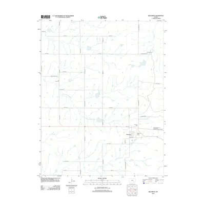
2012 Map of Beaumont
USGS Topo · Published 2012About this map
Beaumont serves as the focal point of this Butler County landscape, characterized by the headwaters of several regional waterways. The drainage patterns of the S Br Little Walnut River and N Br Hickory Cr define the rolling plains, while smaller tributaries like Stony Br and Nicholas Cr carve through the open country. Local history is anchored by a trio of burial grounds, including Beaumont Cem, Little Walnut Cem, and Butts Cem, which provide essential points of reference for genealogists tracking family roots in the township. The presence of the Beaumont Hotel Airport suggests a unique intersection of local hospitality and aviation, while the northern reaches include the recreational grounds of Camp Wiedemann. This survey documents a quiet rural corridor where long-established section roads like SE Gray Rd and Tallgrass St maintain a grid across the watershed.
Find a feature on this map
38 named features on this map. Tap any name to fly to it.
Don’t see what you’re looking for? This feature index may not catch every label — zoom into the map to look around manually.
Map Details
Editions of this 2012 Beaumont Map
This is the sole edition of this map. No revisions or reprints were ever made.
Other maps of this area

1885 · Eureka
USGS Topo · 1:125,000

1888 · Eureka
USGS Topo · 1:125,000

1888 · Eldorado
USGS Topo · 1:125,000

1894 · Eureka
USGS Topo · 1:125,000

1955 · Wichita
USGS Topo · 1:250,000

1958 · Wichita
USGS Topo · 1:250,000

1961 · Pontiac
USGS Topo · 1:24,000

1961 · Rosalia
USGS Topo · 1:24,000
1964 · Piedmont SW
USGS Topo · 1:24,000

1964 · Piedmont NW
USGS Topo · 1:24,000