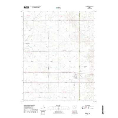
2018 Map of Beaumont
USGS Topo · Published 2018About this map
Beaumont serves as the primary hub in this Kansas landscape, situated near the border of Butler and Greenwood Counties. The town's aviation history is represented by the Beaumont Hotel Airport, while several local burial grounds, including Beaumont Cem, Butts Cem, and Little Walnut Cem, offer significant reference points for genealogists. The topography is defined by a dendritic drainage network feeding the South Branch Little Walnut River and North Branch Hickory Creek, which carve into the terrain alongside roads like the Old State Highway 96 and SE Flinthills Road. The rural grid is further detailed by named arteries such as Junkyard Hill Road and Camp Wiedemann Drive, illustrating the sparse but deliberate development of the Flint Hills region.
Find a feature on this map
44 named features on this map. Tap any name to fly to it.
Don’t see what you’re looking for? This feature index may not catch every label — zoom into the map to look around manually.
Map Details
Editions of this 2018 Beaumont Map
This is the sole edition of this map. No revisions or reprints were ever made.
Other maps of this area

1885 · Eureka
USGS Topo · 1:125,000

1888 · Eureka
USGS Topo · 1:125,000

1888 · Eldorado
USGS Topo · 1:125,000

1894 · Eureka
USGS Topo · 1:125,000

1955 · Wichita
USGS Topo · 1:250,000

1958 · Wichita
USGS Topo · 1:250,000

1961 · Pontiac
USGS Topo · 1:24,000

1961 · Rosalia
USGS Topo · 1:24,000
1964 · Piedmont SW
USGS Topo · 1:24,000

1964 · Piedmont NW
USGS Topo · 1:24,000