
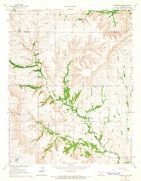
1964 Map of Beaumont
USGS Topo · Published 1965About this map
Beaumont serves as the focal point of this Kansas landscape, positioned at a critical junction of the St Louis San Francisco railroad. The town's local history is anchored by the Beaumont Cem and Butts Cem, while its mid-century infrastructure includes a dedicated Landing Field. The terrain is defined by a dense network of drainages, including the Little Walnut River and its western tributary, Nicholas Creek, which cut through the townships of Rosalia, Glencoe, and Hickory.
Find a feature on this map
19 named features on this map. Tap any name to fly to it.
Don’t see what you’re looking for? This feature index may not catch every label — zoom into the map to look around manually.
Map Details
Editions of this 1964 Beaumont Map
This is the sole edition of this map. No revisions or reprints were ever made.
Other maps of this area

1885 · Eureka
USGS Topo · 1:125,000

1888 · Eureka
USGS Topo · 1:125,000

1888 · Eldorado
USGS Topo · 1:125,000

1894 · Eureka
USGS Topo · 1:125,000

1955 · Wichita
USGS Topo · 1:250,000

1958 · Wichita
USGS Topo · 1:250,000

1961 · Pontiac
USGS Topo · 1:24,000

1961 · Rosalia
USGS Topo · 1:24,000
1964 · Piedmont SW
USGS Topo · 1:24,000

1964 · Piedmont NW
USGS Topo · 1:24,000