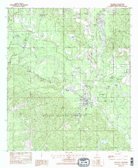
1982 Map of Beaumont
USGS Topo · Published 1982About this map
The town of Beaumont sits at the southern bend of the Leaf River in Perry County, serving as a hub where the Illinois Central Gulf Railroad crosses the landscape. The river's winding path through the De Soto National Forest is defined by sharp geographic features such as Bland Bluff and Fairhope Bluff, while numerous oxbows like Horseshoe Bend Lake and Lott Dead River indicate the ancient movement of the water.
Find a feature on this map
50 named features on this map. Tap any name to fly to it.
Don’t see what you’re looking for? This feature index may not catch every label — zoom into the map to look around manually.
Map Details
Editions of this 1982 Beaumont Map
2 editions found
Other maps of this area

1947 · Beaumont
USGS Topo · 1:62,500

1947 · New Augusta
USGS Topo · 1:62,500

1949 · Beaumont
USGS Topo · 1:62,500

1949 · New Augusta
USGS Topo · 1:62,500

1953 · Hattiesburg
USGS Topo · 1:250,000

1958 · Hattiesburg
USGS Topo · 1:250,000

1963 · Brewer
USGS Topo · 1:24,000

1964 · Ovett SE
USGS Topo · 1:24,000

1964 · Richton
USGS Topo · 1:24,000
1982 · Neely
USGS Topo · 1:24,000