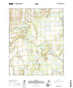
2017 Map of Beaver A-5 NW
USGS Topo · Published 2017About this map
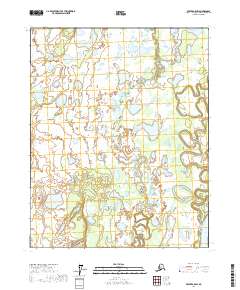
Dall River and the Little Dall River wind through a complex system of wetlands and small lakes within the Yukon Flats region of Alaska. This landscape is characterized by its high density of interior water bodies and meandering river channels, illustrating the hydrological patterns of the northern Yukon-Koyukuk Census Area. The topography is exceptionally level, with subtle elevation changes marked only by the shifting courses of these two primary river systems as they move across the flats. While the area lacks developed settlements or permanent infrastructure, the detailed hydrography and township boundaries, including t16n r9w and t15n r8w, provide essential spatial references for understanding this expansive wilderness at the start of the 21st century.
Find a feature on this map
7 named features on this map. Tap any name to fly to it.
Don’t see what you’re looking for? This feature index may not catch every label — zoom into the map to look around manually.
Map Details
Editions of this 2017 Beaver A-5 NW Map
This is the sole edition of this map. No revisions or reprints were ever made.
Other maps of this area

1951 · Beaver
USGS Topo · 1:250,000

1956 · Beaver A-5
USGS Topo · 1:63,360

1956 · Beaver B-5
USGS Topo · 1:63,360

1956 · Beaver
USGS Topo · 1:250,000

1964 · Beaver
USGS Topo · 1:250,000

1970 · Beaver B-6
USGS Topo · 1:63,360
1970 · Beaver A-6
USGS Topo · 1:63,360
2017 · Beaver A-5 SE
USGS Topo · 1:25,000
2017 · Beaver B-5 SE
USGS Topo · 1:25,000
2017 · Beaver A-5 SW
USGS Topo · 1:25,000