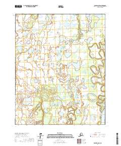
2017 Map of Beaver A-5 SW
USGS Topo · Published 2017About this map
The Yukon River flows through the southeastern corner of this Alaskan interior landscape, marking a prominent bend in one of the most vital waterways in the subarctic. The terrain is defined by an intricate network of wetlands and oxbow lakes, where the Dall River and its tributary, the Little Dall River, meander across the flat alluvial plain. These winding watercourses create a complex hydrological pattern, typical of the Yukon-Koyukuk region, where shifting river channels frequently leave behind isolated features like Horseshoe Lake. The map illustrates the vast, uninhabited character of the river valley in the early 21st century, dominated by saturated soils and slow-moving water rather than permanent roads or settlements. These natural features represent the traditional travel corridors and seasonal grounds used for generations within the Yukon drainage basin.
Find a feature on this map
8 named features on this map. Tap any name to fly to it.
Don’t see what you’re looking for? This feature index may not catch every label — zoom into the map to look around manually.
Map Details
Editions of this 2017 Beaver A-5 SW Map
This is the sole edition of this map. No revisions or reprints were ever made.
Other maps of this area

1945 · Livengood
USGS Topo · 1:250,000

1951 · Livengood
USGS Topo · 1:250,000

1951 · Beaver
USGS Topo · 1:250,000

1952 · Livengood D-5
USGS Topo · 1:63,360

1956 · Beaver A-5
USGS Topo · 1:63,360

1956 · Beaver
USGS Topo · 1:250,000

1956 · Livengood D-6
USGS Topo · 1:63,360

1956 · Livengood
USGS Topo · 1:250,000

1964 · Beaver
USGS Topo · 1:250,000

1964 · Livengood
USGS Topo · 1:250,000