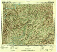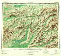
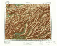
1956 Map of Livengood
USGS Topo · Published 1961About this map
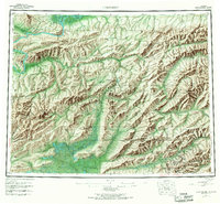
The Yukon River and the jagged ridges of the White Mountains dominate this mid-century view of the Alaska interior. The landscape reflects the transition from early river-based outposts like the Fort Hamlin (Site) to the terrestrial mining developments centered around the Elliott Highway. Concentrations of activity are evident in the southeast corner, where gold mining infrastructure including tailings, a Railroad Grade, and numerous camps such as Pedro Camp and Eldorado Camp dot the hills near Chatanika. Further north, the settlement of Livengood serves as a lone hub of activity between the Tolovana River and the high Livengood Dome. The presence of several landing areas and a network of Winter Trails and Tractor Trails underscores the reliance on seasonal transport and small aircraft in this interior territory before the expansion of modern road systems.
Find a feature on this map
124 named features on this map. Tap any name to fly to it.
Don’t see what you’re looking for? This feature index may not catch every label — zoom into the map to look around manually.
Map Details
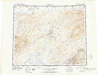
Editions of this 1956 Livengood Map
9 editions found


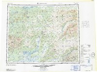
Historical Maps of Livengood Through Time
4 maps found