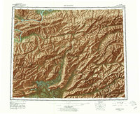
1956 Map of Livengood
USGS Topo · Published 1977About this map
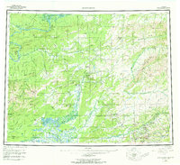
Livengood serves as a central hub in this interior Alaskan landscape, which spans the transition from the high peaks of the White Mountains to the winding river valleys below. Transport in the mid-20th century is defined by a network of the Elliott Highway and Steese Highway, supplemented by a complex web of Winter Roads and Tractor Trails that connected remote mining camps and settlements.
Find a feature on this map
83 named features on this map. Tap any name to fly to it.
Don’t see what you’re looking for? This feature index may not catch every label — zoom into the map to look around manually.
Map Details
Editions of this 1956 Livengood Map
9 editions found

Other maps of this area

1945 · Livengood
USGS Topo · 1:250,000

1948 · Kantishna River
USGS Topo · 1:250,000

1949 · Fairbanks D-1
USGS Topo · 1:62,500

1949 · Fairbanks D-2
USGS Topo · 1:62,500

1949 · Fairbanks D-3
USGS Topo · 1:63,360

1949 · Fairbanks D-4
USGS Topo · 1:63,360

1950 · Fairbanks
USGS Topo · 1:250,000

1950 · Big Delta
USGS Topo · 1:250,000

1950 · Big Delta D-6
USGS Topo · 1:63,360

1950 · Fairbanks D-5
USGS Topo · 1:63,360