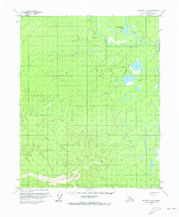
1970 Map of Beaver A-6
USGS Topo · Published 1973About this map
The Fort Hamlin Hills dominate the southern portion of this interior Alaskan landscape, providing a sharp contrast to the water-dense lowlands to the north. At the start of the 1970s, this region remained largely untouched by permanent development, characterized instead by an extensive network of lakes and waterways. The Dall River meanders through the central terrain, feeding into and out of significant water bodies like Guishiemana Lake and the Little Sussaymin Lakes. A singular Winter Road cuts across the northeastern corner, tracing a path that highlights the seasonal nature of transportation and survival in the Yukon-Koyukuk region before the expansion of modern infrastructure. The map preserves the complex drainage patterns and topographical transitions of a wilderness area defined by its hydrology.
Find a feature on this map
5 named features on this map. Tap any name to fly to it.
Don’t see what you’re looking for? This feature index may not catch every label — zoom into the map to look around manually.
Map Details
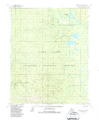
Editions of this 1970 Beaver A-6 Map
2 editions found
Other maps of this area

1945 · Livengood
USGS Topo · 1:250,000

1951 · Bettles
USGS Topo · 1:250,000

1951 · Tanana
USGS Topo · 1:250,000

1951 · Livengood
USGS Topo · 1:250,000

1951 · Beaver
USGS Topo · 1:250,000

1952 · Livengood D-5
USGS Topo · 1:63,360

1956 · Bettles
USGS Topo · 1:250,000

1956 · Beaver A-5
USGS Topo · 1:63,360

1956 · Beaver B-5
USGS Topo · 1:63,360

1956 · Beaver
USGS Topo · 1:250,000