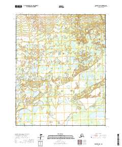
2017 Map of Beaver B-5 SE
USGS Topo · Published 2017About this map
Yukon Flats dominates this interior Alaskan landscape, characterized by a complex network of wetlands and shallow water bodies within the t17n r8w and t18n r7w townships. This 2017 survey by the U.S. Geological Survey captures a remote portion of the Yukon-Koyukuk Census Area where the W Fork of the Forks meanders through a saturated terrain. Notable features include Savayeit Lake, a distinct body of water amidst the countless unnamed ponds and marshes that define this part of the subarctic basin. The map illustrates the characteristic drainage patterns of the Alaskan interior, showing how subtle elevation changes dictate the flow of water across this vast alluvial plain. There are no marked roads or permanent settlements within these boundaries, reflecting the area's continued use for traditional subsistence and its role as a significant migratory bird habitat.
Find a feature on this map
7 named features on this map. Tap any name to fly to it.
Don’t see what you’re looking for? This feature index may not catch every label — zoom into the map to look around manually.
Map Details
Editions of this 2017 Beaver B-5 SE Map
This is the sole edition of this map. No revisions or reprints were ever made.
Other maps of this area

1951 · Beaver
USGS Topo · 1:250,000

1956 · Beaver A-5
USGS Topo · 1:63,360

1956 · Beaver B-5
USGS Topo · 1:63,360

1956 · Beaver
USGS Topo · 1:250,000

1956 · Beaver A-4
USGS Topo · 1:63,360

1956 · Beaver B-4
USGS Topo · 1:63,360

1964 · Beaver
USGS Topo · 1:250,000
2017 · Beaver B-5 NW
USGS Topo · 1:25,000
2017 · Beaver A-5 NE
USGS Topo · 1:25,000
2017 · Beaver B-5 SW
USGS Topo · 1:25,000