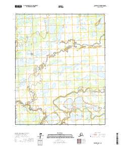
2017 Map of Beaver A-5 NE
USGS Topo · Published 2017About this map
Yukon Flats forms the backdrop for this drainage basin within the Yukon-Koyukuk Census Area, where a complex network of waterways defines the landscape. The geography is centered on a series of distinctive water bodies, including Geese Lake, Horse Lake, and the expansive Gushdoiman Lake. The hydrography is notably intricate, featuring the confluence known as The Forks, where the West Fork of the Forks and East Fork of the Forks meet. In the southern portion of the map, the meandering path of Pat Cr and the Dall River illustrate the slow-moving, braided nature of this subarctic wetland system. This 2017 survey by the U.S. Geological Survey provides a precise record of these shifting shorelines and the remote Minkoshchaliton Lake, capturing a region where the environment is dictated entirely by its water patterns and seasonal flow.
Find a feature on this map
15 named features on this map. Tap any name to fly to it.
Don’t see what you’re looking for? This feature index may not catch every label — zoom into the map to look around manually.
Map Details
Editions of this 2017 Beaver A-5 NE Map
This is the sole edition of this map. No revisions or reprints were ever made.
Other maps of this area

1951 · Beaver
USGS Topo · 1:250,000

1956 · Beaver A-5
USGS Topo · 1:63,360

1956 · Beaver B-5
USGS Topo · 1:63,360

1956 · Beaver
USGS Topo · 1:250,000

1956 · Beaver A-4
USGS Topo · 1:63,360

1956 · Beaver B-4
USGS Topo · 1:63,360

1964 · Beaver
USGS Topo · 1:250,000
2017 · Beaver A-5 SE
USGS Topo · 1:25,000
2017 · Beaver B-5 SE
USGS Topo · 1:25,000
2017 · Beaver A-5 SW
USGS Topo · 1:25,000