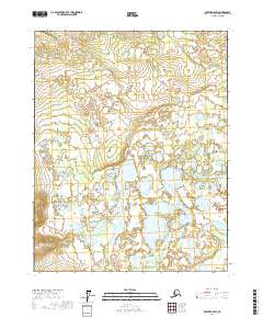
2017 Map of Beaver B-5 SW
USGS Topo · Published 2017About this map
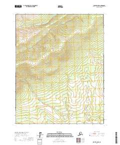
Yukon Flats defines the landscape of this 2017 survey, a complex network of wetlands and scattered water bodies in the Yukon-Koyukuk region of Alaska. The area is dominated by an intricate hydrographic system, where Tishdogatumina Lake and Echoing Lake stand out as the primary named features among hundreds of smaller, unnamed ponds and seasonal sloughs. These lakes sit within a sprawling alluvial basin, illustrating the seasonal drainage patterns common to this subarctic wilderness. The map details the Public Land Survey System grid including t18n r9w, t18n r8w, t17n r9w, and t17n r8w, which provide a vital framework for land management in an area otherwise devoid of human infrastructure or roads. This document is a precise record of the shoreline configurations and aquatic boundaries that shift within this dynamic environment.
Find a feature on this map
7 named features on this map. Tap any name to fly to it.
Don’t see what you’re looking for? This feature index may not catch every label — zoom into the map to look around manually.
Map Details
Editions of this 2017 Beaver B-5 SW Map
This is the sole edition of this map. No revisions or reprints were ever made.
Other maps of this area

1951 · Beaver
USGS Topo · 1:250,000

1956 · Beaver A-5
USGS Topo · 1:63,360

1956 · Beaver B-5
USGS Topo · 1:63,360

1956 · Beaver
USGS Topo · 1:250,000

1964 · Beaver
USGS Topo · 1:250,000

1970 · Beaver B-6
USGS Topo · 1:63,360
1970 · Beaver A-6
USGS Topo · 1:63,360
2017 · Beaver B-6 NE
USGS Topo · 1:25,000
2017 · Beaver B-5 SE
USGS Topo · 1:25,000
2017 · Beaver B-5 NW
USGS Topo · 1:25,000