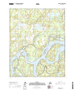
2017 Map of Beaver B-1 NE
USGS Topo · Published 2017About this map
The Yukon River dominates this interior Alaska landscape, carving a complex network of braided channels and side-waters through the Yukon-Koyukuk region. In this 2017 study, the river’s dynamic nature is evident in the formation of Joe Devlin Island and the meandering paths of Tony Slough and Jack Uheen Slough. These seasonal waterways define the transport and subsistence patterns of the area, connecting the main river channel to more remote interior basins.
Find a feature on this map
12 named features on this map. Tap any name to fly to it.
Don’t see what you’re looking for? This feature index may not catch every label — zoom into the map to look around manually.
Map Details
Editions of this 2017 Beaver B-1 NE Map
This is the sole edition of this map. No revisions or reprints were ever made.
Other maps of this area

1951 · Fort Yukon
USGS Topo · 1:250,000

1951 · Beaver
USGS Topo · 1:250,000

1956 · Fort Yukon B-6
USGS Topo · 1:63,360

1956 · Beaver
USGS Topo · 1:250,000

1956 · Beaver B-1
USGS Topo · 1:63,360

1956 · Fort Yukon
USGS Topo · 1:250,000
1956 · Fort Yukon C-6
USGS Topo · 1:63,360

1964 · Beaver
USGS Topo · 1:250,000
1990 · Beaver C-1
USGS Topo · 1:63,360
2017 · Beaver B-1 SW
USGS Topo · 1:25,000