
1956 Map of Fort Yukon B-6
USGS Topo · Published 1959About this map
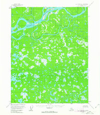
White Eye Village sits along a complex network of braids and islands where the Hadweenzic River meets the Yukon River. This mid-century survey illustrates a dynamic hydrological landscape dominated by the winding paths of Beaver Creek and Lower Mouth Birch Creek. The region is defined by a dense concentration of small lakes and ponds across the flats, punctuated by isolated Cabin and Cabins that indicate the seasonal or subsistence use of these waterways. The map details the intricate connections of the Lower Mouth Slough and Fish Creek, revealing how the landscape remained shaped by the shifting currents and alluvial deposits of the great northern river systems before significant modern development.
Find a feature on this map
9 named features on this map. Tap any name to fly to it.
Don’t see what you’re looking for? This feature index may not catch every label — zoom into the map to look around manually.
Map Details
Editions of this 1956 Fort Yukon B-6 Map
3 editions found
Other maps of this area

1951 · Fort Yukon
USGS Topo · 1:250,000

1951 · Beaver
USGS Topo · 1:250,000

1955 · Fort Yukon C-5
USGS Topo · 1:63,360
1956 · Beaver A-1
USGS Topo · 1:63,360
1956 · Fort Yukon A-6
USGS Topo · 1:63,360

1956 · Beaver
USGS Topo · 1:250,000

1956 · Fort Yukon C-5
USGS Topo · 1:63,360

1956 · Fort Yukon A-5
USGS Topo · 1:63,360

1956 · Beaver B-1
USGS Topo · 1:63,360

1956 · Fort Yukon B-5
USGS Topo · 1:63,360