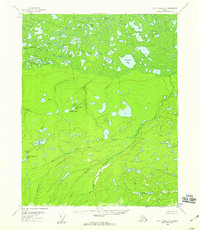
1956 Map of Fort Yukon A-6
USGS Topo · Published 1959About this map
Beaver Creek and its complex system of sloughs and lakes dominate this mid-century survey of the Alaskan interior. The landscape transition is marked by the low-lying, lake-strewn wetlands of the north, including the curiously named Stinking Lake and Clam Lake, which give way to the more defined drainage of the Flat and the Big Creek valley to the south. Human presence is sparse, represented by Swede Boys Camp and isolated cabins, reflecting the seasonal subsistence and trapping patterns of the era. The intricate network of waterways like Long Slough and Mud Canyon suggests a region where travel was dictated by river levels and winter ice. Notable family or localized landmarks such as John Roberts Lake and Olaf Lake provide specific points of interest for those researching the geographical history of the Yukon-Koyukuk region before more modern infrastructure reached this part of the territory.
Find a feature on this map
31 named features on this map. Tap any name to fly to it.
Don’t see what you’re looking for? This feature index may not catch every label — zoom into the map to look around manually.
Map Details
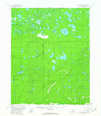
Editions of this 1956 Fort Yukon A-6 Map
2 editions found
Other maps of this area

1945 · Livengood
USGS Topo · 1:250,000

1951 · Fort Yukon
USGS Topo · 1:250,000

1951 · Livengood
USGS Topo · 1:250,000

1951 · Beaver
USGS Topo · 1:250,000

1951 · Circle
USGS Topo · 1:250,000

1951 · Circle D-6
USGS Topo · 1:63,360

1952 · Livengood D-1
USGS Topo · 1:63,360

1952 · Circle D-5
USGS Topo · 1:63,360

1954 · Circle D-5
USGS Topo · 1:63,360

1954 · Circle D-6
USGS Topo · 1:63,360