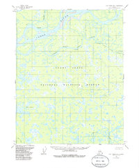
1956 Map of Fort Yukon B-6
USGS Topo · Published 1985About this map
The Yukon Flats National Wildlife Refuge dominates this subarctic landscape, characterized by an intricate network of waterways and thousands of small ponds. The Yukon River meanders across the northern portion of the sheet, joined by the Hadwenzi River and creating a complex system of sloughs and channels. Evidence of seasonal habitation or wilderness outposts is visible at White Eye and several isolated Cabins along the riverbanks, typical of the mid-century interior Alaskan wilderness.
Find a feature on this map
13 named features on this map. Tap any name to fly to it.
Don’t see what you’re looking for? This feature index may not catch every label — zoom into the map to look around manually.
Map Details
Editions of this 1956 Fort Yukon B-6 Map
3 editions found
Other maps of this area

1951 · Fort Yukon
USGS Topo · 1:250,000

1951 · Beaver
USGS Topo · 1:250,000

1955 · Fort Yukon C-5
USGS Topo · 1:63,360

1956 · Fort Yukon B-6
USGS Topo · 1:63,360
1956 · Beaver A-1
USGS Topo · 1:63,360
1956 · Fort Yukon A-6
USGS Topo · 1:63,360

1956 · Beaver
USGS Topo · 1:250,000

1956 · Fort Yukon C-5
USGS Topo · 1:63,360

1956 · Fort Yukon A-5
USGS Topo · 1:63,360

1956 · Beaver B-1
USGS Topo · 1:63,360