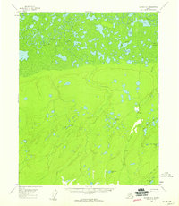
1956 Map of Beaver A-1
USGS Topo · Published 1959About this map
Beaver Creek meanders through a dense network of wetlands and oxbow lakes in this mid-century portrait of the Alaskan interior. The landscape is defined by its transition from the low-lying marshy plains of Big Meadow and Jefferson Meadows to the rising terrain of the southern half. A solitary Winter Trail cuts across the northwestern corner, representing the vital seasonal transportation routes used when the ground was frozen. Human presence is sparse but precisely noted, with several Cabins and isolated Cabin sites situated near water sources like Jefferson Creek and Little Beaver Lake. The map details a complex hydrography including Shallow Lake, Rat Lake, and the New Halfway Lakes, illustrating the intricate drainage patterns of the Yukon-Koyukuk region before modern development or significant climate shifts altered the landscape.
Find a feature on this map
17 named features on this map. Tap any name to fly to it.
Don’t see what you’re looking for? This feature index may not catch every label — zoom into the map to look around manually.
Map Details
Editions of this 1956 Beaver A-1 Map
2 editions found
Other maps of this area

1945 · Livengood
USGS Topo · 1:250,000

1951 · Fort Yukon
USGS Topo · 1:250,000

1951 · Livengood
USGS Topo · 1:250,000

1951 · Beaver
USGS Topo · 1:250,000

1951 · Circle
USGS Topo · 1:250,000

1951 · Circle D-6
USGS Topo · 1:63,360

1952 · Livengood D-2
USGS Topo · 1:63,360

1952 · Livengood D-1
USGS Topo · 1:63,360
1954 · Livengood D-2
USGS Topo · 1:63,360

1954 · Circle D-6
USGS Topo · 1:63,360