
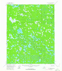
1956 Map of Fort Yukon B-5
USGS Topo · Published 1959About this map
The Yukon River cuts across the northwest corner of this sub-arctic landscape, where a complex network of wetlands and meandering waterways dominates the terrain. This 1950s survey captures a wilderness characterized by the intricate drainage systems of Beaver Creek and the bifurcating paths of Upper Mouth Birch Creek and Lower Mouth Birch Creek. The presence of a solitary Cabin suggests infrequent human habitation or seasonal subsistence use in an area otherwise defined by its hydrological patterns. Survey points like VABM Gran 411 provide topographic anchors amidst the countless lakes and ponds. The map illustrates the natural hydraulic transitions where Tajittro Creek feeds into the larger marsh systems, showing the landscape before significant modern changes in the region's environmental management.
Find a feature on this map
9 named features on this map. Tap any name to fly to it.
Don’t see what you’re looking for? This feature index may not catch every label — zoom into the map to look around manually.
Map Details
Editions of this 1956 Fort Yukon B-5 Map
2 editions found
Other maps of this area

1951 · Fort Yukon
USGS Topo · 1:250,000

1952 · Fort Yukon C-4
USGS Topo · 1:63,360

1955 · Fort Yukon C-5
USGS Topo · 1:63,360

1956 · Fort Yukon B-6
USGS Topo · 1:63,360

1956 · Fort Yukon B-4
USGS Topo · 1:63,360

1956 · Fort Yukon A-4
USGS Topo · 1:63,360
1956 · Fort Yukon A-6
USGS Topo · 1:63,360

1956 · Fort Yukon C-5
USGS Topo · 1:63,360

1956 · Fort Yukon A-5
USGS Topo · 1:63,360

1956 · Fort Yukon
USGS Topo · 1:250,000