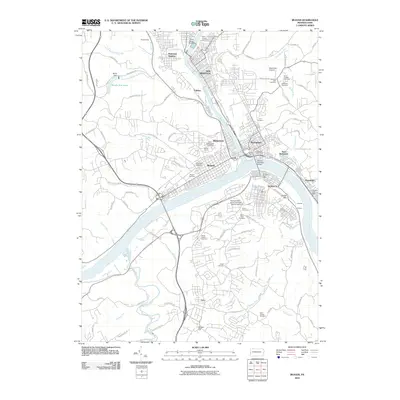
2010 Map of Beaver
USGS Topo · Published 2010About this map
The confluence of the Ohio River and the Beaver River dominates this 2010 survey, anchoring a dense network of river-town communities. In this industrial and residential landscape, established boroughs like Rochester, Beaver, and New Brighton are shown alongside smaller riverside locations such as Bakers Landing and Colona. The map provides significant detail for local historians, identifying numerous community hubs like the Pennsylvania State University - Beaver Campus and the Rochester Post Office. The varied topography north of the rivers is marked by the sprawling Sylvania Hills Cemetery and the recreational waters of Bradys Run Lake behind Brady Dam. Further south, the landscape transitions into the rolling hills of Center Township, where family and parish history is preserved at the Saint Johns Cemetery and Chapel Cemetery near the community of Shafers.
Find a feature on this map
109 named features on this map. Tap any name to fly to it.
Don’t see what you’re looking for? This feature index may not catch every label — zoom into the map to look around manually.
Map Details
Editions of this 2010 Beaver Map
This is the sole edition of this map. No revisions or reprints were ever made.
Other maps of this area

1901 · Beaver
USGS Topo · 1:62,500

1902 · New Castle
USGS Topo · 1:62,500

1904 · Newcastle
USGS Topo · 1:62,500

1904 · Beaver
USGS Topo · 1:62,500

1906 · Sewickley
USGS Topo · 1:62,500

1908 · Sewickley
USGS Topo · 1:62,500

1908 · Zelienople
USGS Topo · 1:62,500

1910 · Zelienople
USGS Topo · 1:62,500

1951 · Canton
USGS Topo · 1:250,000

1953 · Canton
USGS Topo · 1:250,000