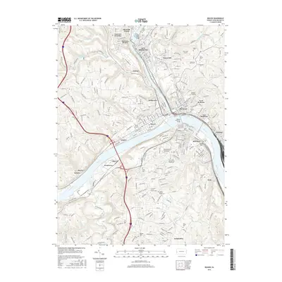
2016 Map of Beaver
USGS Topo · Published 2016About this map
The confluence of the Beaver River and the Ohio River serves as the industrial and social heart of this 2016 survey, where the river-and-rail economy of Western Pennsylvania is on full display. Dense urban development clusters around the historic boroughs of Beaver Falls, Rochester, and Monaca, with the CSX railroad tracing the water's edge. This modern edition captures a region where heavy industry and residential life are tightly integrated, seen in the proximity of Joseptown and Industry to numerous religious and memorial sites like the Beaver Cem and Mausoleum and Saint Cecilia Cem. Educational institutions including Penn State Beaver and the Community College of Beaver County occupy significant tracts on the plateaus above the river valleys. Landmarks such as the Monaca Rochester Bridge and Lacock Bar highlight the critical role of river navigation and crossing in this transit-heavy corridor.
Find a feature on this map
297 named features on this map. Tap any name to fly to it.
Don’t see what you’re looking for? This feature index may not catch every label — zoom into the map to look around manually.
Map Details
Editions of this 2016 Beaver Map
This is the sole edition of this map. No revisions or reprints were ever made.
Other maps of this area

1901 · Beaver
USGS Topo · 1:62,500

1902 · New Castle
USGS Topo · 1:62,500

1904 · Newcastle
USGS Topo · 1:62,500

1904 · Beaver
USGS Topo · 1:62,500

1906 · Sewickley
USGS Topo · 1:62,500

1908 · Sewickley
USGS Topo · 1:62,500

1908 · Zelienople
USGS Topo · 1:62,500

1910 · Zelienople
USGS Topo · 1:62,500

1951 · Canton
USGS Topo · 1:250,000

1953 · Canton
USGS Topo · 1:250,000