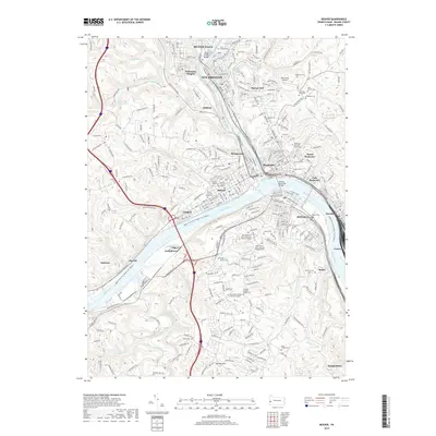
2019 Map of Beaver
USGS Topo · Published 2019About this map
The confluence of the Beaver River and the Ohio River serves as the centerpiece for this 2019 survey, illustrating the densely settled riverfront communities of Beaver County. Industrial and transportation networks are prominent, featuring the Conrail line and the Upper Ohio River Water Trail. The map details a cluster of historical borough centers, including New Brighton, Rochester, and Beaver, where the Beaver County Courthouse stands as a focal point.
Find a feature on this map
275 named features on this map. Tap any name to fly to it.
Don’t see what you’re looking for? This feature index may not catch every label — zoom into the map to look around manually.
Map Details
Editions of this 2019 Beaver Map
This is the sole edition of this map. No revisions or reprints were ever made.
Other maps of this area

1901 · Beaver
USGS Topo · 1:62,500

1902 · New Castle
USGS Topo · 1:62,500

1904 · Newcastle
USGS Topo · 1:62,500

1904 · Beaver
USGS Topo · 1:62,500

1906 · Sewickley
USGS Topo · 1:62,500

1908 · Sewickley
USGS Topo · 1:62,500

1908 · Zelienople
USGS Topo · 1:62,500

1910 · Zelienople
USGS Topo · 1:62,500

1951 · Canton
USGS Topo · 1:250,000

1953 · Canton
USGS Topo · 1:250,000