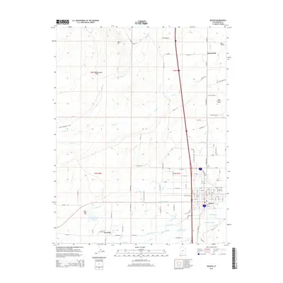
2014 Map of Beaver
USGS Topo · Published 2014About this map
The Beaver River and a complex system of irrigation infrastructure define the landscape of the eastern Beaver Valley. This survey documents the critical water management networks that support the agricultural settlements of Greenville and Manderfield. Named canals and ditches, such as Northwest Ditch, City Ditch, and Carter Ditch, illustrate the diversion of natural flows from North Cr and the Beaver River to feed the valley's fields.
Find a feature on this map
103 named features on this map. Tap any name to fly to it.
Don’t see what you’re looking for? This feature index may not catch every label — zoom into the map to look around manually.
Map Details
Editions of this 2014 Beaver Map
This is the sole edition of this map. No revisions or reprints were ever made.
Other maps of this area

1885 · Beaver
USGS Topo · 1:250,000

1953 · Richfield
USGS Topo · 1:250,000

1954 · Beaver SE
USGS Topo · 1:24,000

1954 · Beaver NE
USGS Topo · 1:24,000

1958 · Richfield
USGS Topo · 1:250,000

1958 · Minersville
USGS Topo · 1:62,500

1958 · Beaver
USGS Topo · 1:62,500

1958 · Adamsville
USGS Topo · 1:62,500
1971 · Kane Canyon
USGS Topo · 1:24,000
1971 · Greenville Bench
USGS Topo · 1:24,000