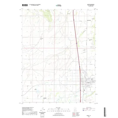
2020 Map of Beaver
USGS Topo · Published 2020About this map
Beaver serves as the focal point of this modern topographical study, situated at the intersection of a complex historical irrigation network and the high desert landscape. The town's layout is defined by a rigid grid of residential streets like W 600 North St and E 300 South St, buffered to the east by the Beaver City Cem and Mountain View Cem. This area demonstrates the critical role of water management in Utah's development, evidenced by the numerous named ditches and sloughs including City Ditch, Greenwood Slough, and the S Field Ditch.
Find a feature on this map
49 named features on this map. Tap any name to fly to it.
Don’t see what you’re looking for? This feature index may not catch every label — zoom into the map to look around manually.
Map Details
Editions of this 2020 Beaver Map
This is the sole edition of this map. No revisions or reprints were ever made.
Other maps of this area

1885 · Beaver
USGS Topo · 1:250,000

1953 · Richfield
USGS Topo · 1:250,000

1954 · Beaver SE
USGS Topo · 1:24,000

1954 · Beaver NE
USGS Topo · 1:24,000

1958 · Richfield
USGS Topo · 1:250,000

1958 · Minersville
USGS Topo · 1:62,500

1958 · Beaver
USGS Topo · 1:62,500

1958 · Adamsville
USGS Topo · 1:62,500
1971 · Kane Canyon
USGS Topo · 1:24,000
1971 · Greenville Bench
USGS Topo · 1:24,000