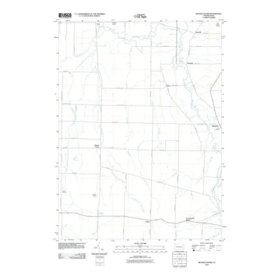
2010 Map of Beaver Center
USGS Topo · Published 2010About this map
Beaver Center sits at the heart of this rural landscape, where the headwaters of the Conneaut Creek system carve through western Crawford County. This 2010 survey highlights a distinctly agrarian and aviation-focused community, featuring several small airfields including Freeman Airport, Port Albion Airport, and Pontius Airport. The drainage patterns are particularly intricate here, as the West Branch, Middle Branch, and East Branch Conneaut Creek converge to form the primary waterway. Local history is anchored by long-standing burial grounds like White Cemetery, Spring Cemetery, and Brooks Cemetery. The map also captures the layout of small rail-side and crossroads settlements such as Conneautville Station, Pennside, and Keepville, providing a modern view of their historic footprints along the creek corridors.
Find a feature on this map
59 named features on this map. Tap any name to fly to it.
Don’t see what you’re looking for? This feature index may not catch every label — zoom into the map to look around manually.
Map Details
Editions of this 2010 Beaver Center Map
This is the sole edition of this map. No revisions or reprints were ever made.
Other maps of this area

1900 · Girard
USGS Topo · 1:62,500

1905 · Andover
USGS Topo · 1:48,000

1906 · Conneaut
USGS Topo · 1:62,500

1906 · Linesville
USGS Topo · 1:62,500

1907 · Andover
USGS Topo · 1:62,500

1908 · Linesville
USGS Topo · 1:62,500

1950 · Cleveland
USGS Topo · 1:250,000

1956 · Cleveland
USGS Topo · 1:250,000

1959 · Conneautville
USGS Topo · 1:24,000

1959 · East Springfield
USGS Topo · 1:24,000