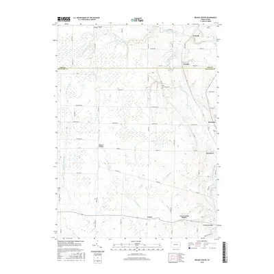
2016 Map of Beaver Center
USGS Topo · Published 2016About this map
The agricultural valleys of northwestern Pennsylvania define this landscape, where Conneaut Creek and its many tributaries, including Stone Run and Crazy Run, carve through the terrain. The map captures a network of small settlements and rural crossroads such as Beaver Center, Pennside, and Keepville as they appeared in 2016. The southern portion of the sheet is anchored by the larger communities of Conneautville and Springboro, connected by a grid of secondary roads like Fisher Rd and Beaver St.
Find a feature on this map
43 named features on this map. Tap any name to fly to it.
Don’t see what you’re looking for? This feature index may not catch every label — zoom into the map to look around manually.
Map Details
Editions of this 2016 Beaver Center Map
This is the sole edition of this map. No revisions or reprints were ever made.
Other maps of this area

1900 · Girard
USGS Topo · 1:62,500

1905 · Andover
USGS Topo · 1:48,000

1906 · Conneaut
USGS Topo · 1:62,500

1906 · Linesville
USGS Topo · 1:62,500

1907 · Andover
USGS Topo · 1:62,500

1908 · Linesville
USGS Topo · 1:62,500

1950 · Cleveland
USGS Topo · 1:250,000

1956 · Cleveland
USGS Topo · 1:250,000

1959 · Conneautville
USGS Topo · 1:24,000

1959 · East Springfield
USGS Topo · 1:24,000