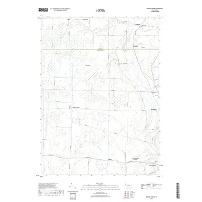
2019 Map of Beaver Center
USGS Topo · Published 2019About this map
Beaver Center serves as a quiet inland hub in this rural landscape near the boundary of Erie and Crawford counties. The terrain is defined by the complex drainage of the West Branch Conneaut Creek, along with its Middle and East branches, which carve through the farmland to the west. To the east, the larger Conneaut Creek guides the development of settlements like Springboro and Conneautville, where the village structures follow the water's path. Small hamlets such as Keepville and Pennside occupy the northern reaches, while the southern portion features the community of Palmer and the Conneautville Station. Genealogists will find a high density of burial sites across the township, including Beaver Center Cem, Keepville Cem, and the Saint Peters Cem, many situated near established family-named roads like Griffey Rd and Barney Rd.
Find a feature on this map
75 named features on this map. Tap any name to fly to it.
Don’t see what you’re looking for? This feature index may not catch every label — zoom into the map to look around manually.
Map Details
Editions of this 2019 Beaver Center Map
This is the sole edition of this map. No revisions or reprints were ever made.
Other maps of this area

1900 · Girard
USGS Topo · 1:62,500

1905 · Andover
USGS Topo · 1:48,000

1906 · Conneaut
USGS Topo · 1:62,500

1906 · Linesville
USGS Topo · 1:62,500

1907 · Andover
USGS Topo · 1:62,500

1908 · Linesville
USGS Topo · 1:62,500

1950 · Cleveland
USGS Topo · 1:250,000

1956 · Cleveland
USGS Topo · 1:250,000

1959 · Conneautville
USGS Topo · 1:24,000

1959 · East Springfield
USGS Topo · 1:24,000