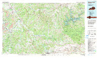
1981 Map of Beaver Dam
USGS Topo · Published 1984About this map
Mammoth Cave National Park dominates the eastern landscape of this 1981 survey, where the rugged topography of The Knobs meets the winding path of the Green River. The region’s development is defined by its waterways and transport corridors, including the Western Kentucky Parkway and the Seaboard System railroad. Key settlements like Morgantown, Hartford, and Beaver Dam serve as central hubs for the surrounding rural communities.
Find a feature on this map
109 named features on this map. Tap any name to fly to it.
Don’t see what you’re looking for? This feature index may not catch every label — zoom into the map to look around manually.
Map Details
Editions of this 1981 Beaver Dam Map
This is the sole edition of this map. No revisions or reprints were ever made.
Other maps of this area

1906 · Sutherland
USGS Topo · 1:62,500

1907 · Whitesville
USGS Topo · 1:62,500

1909 · Whitesville
USGS Topo · 1:62,500

1909 · Hartford
USGS Topo · 1:62,500

1909 · Central City
USGS Topo · 1:62,500

1911 · Drakesboro
USGS Topo · 1:48,000

1911 · Dunmor
USGS Topo · 1:48,000

1913 · Drakesboro
USGS Topo · 1:62,500

1914 · Little Muddy
USGS Topo · 1:62,500

1914 · Dunmor
USGS Topo · 1:62,500