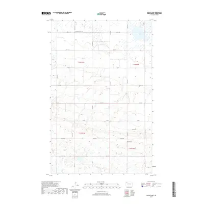
2017 Map of Beaver Lake
USGS Topo · Published 2017About this map
Grand View Lutheran Cem and Tonset Cem stand as silent sentinels over the prairie landscape of Burke County, providing a vital point of reference for genealogists and local historians. This modern survey reflects the enduring grid of the Public Land Survey System, with townships like t162n r93w and t162n r92w neatly partitioned by a network of gravel roads. The terrain is characterized by numerous small potholes and wetlands typical of the northern plains, surrounding the primary water body of Beaver Lake. Local transit is anchored by routes such as Co Rd 7 and Co Rd 4, which cut across the sections and connect the scattered homesteads of this agricultural region. The inclusion of Foothills Dr in the southeastern quadrant suggests a transition in the local geography towards the hills that border this portion of the state.
Find a feature on this map
23 named features on this map. Tap any name to fly to it.
Don’t see what you’re looking for? This feature index may not catch every label — zoom into the map to look around manually.
Map Details
Editions of this 2017 Beaver Lake Map
This is the sole edition of this map. No revisions or reprints were ever made.
Other maps of this area

1947 · Columbus
USGS Topo · 1:24,000

1948 · Beaver Lake
USGS Topo · 1:24,000

1948 · Stampede
USGS Topo · 1:24,000

1949 · Rennie Lake
USGS Topo · 1:24,000

1949 · Portal
USGS Topo · 1:24,000

1949 · Columbus
USGS Topo · 1:24,000

1949 · Columbus SE
USGS Topo · 1:24,000

1950 · Columbus
USGS Topo · 1:62,500

1950 · Portal
USGS Topo · 1:62,500

1953 · Williston
USGS Topo · 1:250,000