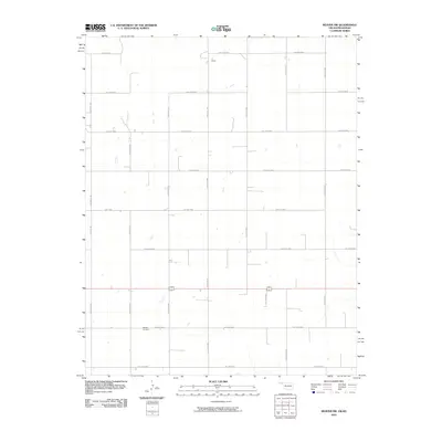
2010 Map of Beaver NW
USGS Topo · Published 2010About this map
The Midway Cemetery stands as a primary landmark in this rural landscape along the Oklahoma and Kansas border, south of Liberal and north of Beaver. This 2010 survey reflects a deeply organized agricultural grid system, where section lines are defined by a network of local roads including Hollow N1290 and Hollow E0080. The area is characterized by vast open tracts and large-scale ranching operations, such as the LT Ranch, which occupies the northern portion of the quadrangle. The topography is subtle, with drainage patterns marked by dry hollows that cut across the cardinal-aligned road network. The presence of Hwy E0050 and numerous numeric local routes illustrates the modern infrastructure supporting the sparse, ranch-driven settlement pattern common in the High Plains during the early 21st century.
Find a feature on this map
19 named features on this map. Tap any name to fly to it.
Don’t see what you’re looking for? This feature index may not catch every label — zoom into the map to look around manually.
Map Details
Editions of this 2010 Beaver NW Map
This is the sole edition of this map. No revisions or reprints were ever made.
Other maps of this area

1954 · Perryton
USGS Topo · 1:250,000

1955 · Dodge City
USGS Topo · 1:250,000

1958 · Perryton
USGS Topo · 1:250,000

1958 · Dodge City
USGS Topo · 1:250,000

1959 · Dodge City
USGS Topo · 1:250,000

1963 · Kismet SE
USGS Topo · 1:24,000

1971 · Kismet SW
USGS Topo · 1:24,000

1971 · Hayne
USGS Topo · 1:24,000

1973 · Floris
USGS Topo · 1:24,000
1973 · Forgan
USGS Topo · 1:24,000