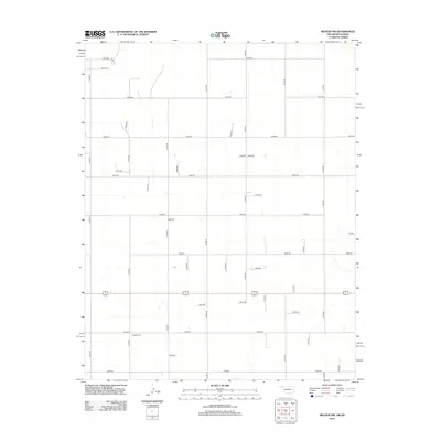
2012 Map of Beaver NW
USGS Topo · Published 2012About this map
Midway Cem serves as a central landmark in this portion of Seward County, situated along the grid of agricultural section roads. The landscape is defined by a rigorous systematic survey, with major north-south corridors like N1300 Rd and N1320 Rd intersecting east-west routes such as E0020 Rd and E0040 Rd. This layout reflects the long-standing land management practices of the High Plains, where access is dictated by the section line system. Small natural depressions and drainage features occasionally disrupt the straight lines of the rural road network, particularly near E0060 Rd and e0065. The dominance of the transportation grid over the natural topography indicates a highly organized agricultural environment during the early 21st century.
Find a feature on this map
40 named features on this map. Tap any name to fly to it.
Don’t see what you’re looking for? This feature index may not catch every label — zoom into the map to look around manually.
Map Details
Editions of this 2012 Beaver NW Map
This is the sole edition of this map. No revisions or reprints were ever made.
Other maps of this area

1954 · Perryton
USGS Topo · 1:250,000

1955 · Dodge City
USGS Topo · 1:250,000

1958 · Perryton
USGS Topo · 1:250,000

1958 · Dodge City
USGS Topo · 1:250,000

1959 · Dodge City
USGS Topo · 1:250,000

1963 · Kismet SE
USGS Topo · 1:24,000

1971 · Kismet SW
USGS Topo · 1:24,000

1971 · Hayne
USGS Topo · 1:24,000

1973 · Floris
USGS Topo · 1:24,000
1973 · Forgan
USGS Topo · 1:24,000