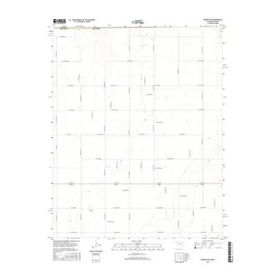
2016 Map of Beaver NW
USGS Topo · Published 2016About this map
The state line between Kansas and Oklahoma divides this high plains landscape, marking the transition between Seward County and Beaver County. This 2016 survey illustrates a strictly organized section-line road network characteristic of the region, where gravel and dirt routes like Hollow N1260 and Hollow N1290 define a precise agricultural grid. A notable exception to this geometric regularity is the passage of Hwy E0050 and the east-west corridor of Hollow E0080. Local history is centered at the Midway Cem, a solitary landmark that serves as a vital touchstone for genealogists and researchers tracking family roots in this rural borderland.
Find a feature on this map
36 named features on this map. Tap any name to fly to it.
Don’t see what you’re looking for? This feature index may not catch every label — zoom into the map to look around manually.
Map Details
Editions of this 2016 Beaver NW Map
This is the sole edition of this map. No revisions or reprints were ever made.
Other maps of this area

1954 · Perryton
USGS Topo · 1:250,000

1955 · Dodge City
USGS Topo · 1:250,000

1958 · Perryton
USGS Topo · 1:250,000

1958 · Dodge City
USGS Topo · 1:250,000

1959 · Dodge City
USGS Topo · 1:250,000

1963 · Kismet SE
USGS Topo · 1:24,000

1971 · Kismet SW
USGS Topo · 1:24,000

1971 · Hayne
USGS Topo · 1:24,000

1973 · Floris
USGS Topo · 1:24,000
1973 · Forgan
USGS Topo · 1:24,000