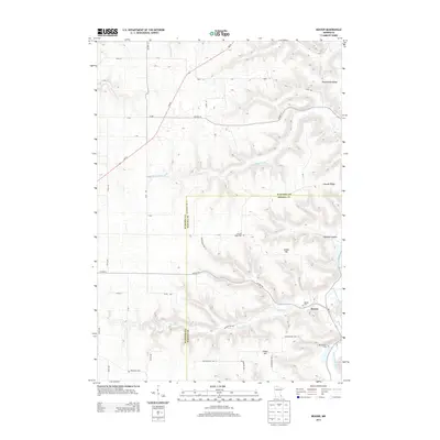
2013 Map of Beaver
USGS Topo · Published 2013About this map
Beaver sits at the confluence of several vital watercourses, where the Beaver Cr meets the winding Whitewater River. This landscape is defined by its deep valley carvings, most notably Glendale Hollow, which separate prominent rises such as Jacobs Hill and Fisher Hill. The settlement pattern reflects the area's rural history, with multiple burial grounds including the Hoosier Ridge Cem and Whitewater Cem situated near the county line between Wabasha and Winona counties.
Find a feature on this map
44 named features on this map. Tap any name to fly to it.
Don’t see what you’re looking for? This feature index may not catch every label — zoom into the map to look around manually.
Map Details
Editions of this 2013 Beaver Map
This is the sole edition of this map. No revisions or reprints were ever made.
Other maps of this area

1932 · Cochrane
USGS Topo · 1:62,500

1932 · Wabasha
USGS Topo · 1:62,500

1932 · Alma
USGS Topo · 1:62,500

1934 · Plainview
USGS Topo · 1:62,500

1934 · Cochrane
USGS Topo · 1:62,500

1937 · Cochrane
USGS Topo · 1:62,500

1938 · Plainview
USGS Topo · 1:62,500

1950 · Alma
USGS Topo · 1:62,500

1951 · Wabasha
USGS Topo · 1:62,500

1953 · Saint Paul
USGS Topo · 1:250,000