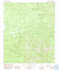
1991 Map of Beaverhead
USGS Topo · Published 1991About this map
Apache National Forest dominates this mountain landscape in Greenlee County, characterized by a complex network of drainage basins and high-elevation landmarks. The settlement of Beaverhead sits at the junction of several watercourses, including Beaver Creek and Hannagan Creek, serving as a focal point for the region's limited human footprint. The topography is defined by significant features such as Middle Mountain and the uniquely named Devils Washboard, reflecting a landscape sculpted by deep canyons and prominent ridges.
Find a feature on this map
30 named features on this map. Tap any name to fly to it.
Don’t see what you’re looking for? This feature index may not catch every label — zoom into the map to look around manually.
Map Details
Editions of this 1991 Beaverhead Map
2 editions found
Other maps of this area

1922 · Nutrioso
USGS Topo · 1:125,000

1954 · Clifton
USGS Topo · 1:250,000

1957 · Clifton
USGS Topo · 1:250,000

1958 · Clifton
USGS Topo · 1:250,000

1958 · Alpine
USGS Topo · 1:62,500

1958 · Hannagan Meadow
USGS Topo · 1:62,500

1958 · Big Lake
USGS Topo · 1:62,500

1961 · Blue
USGS Topo · 1:62,500

1962 · Clifton
USGS Topo · 1:250,000
1981 · Nutrioso
USGS Topo · 1:100,000