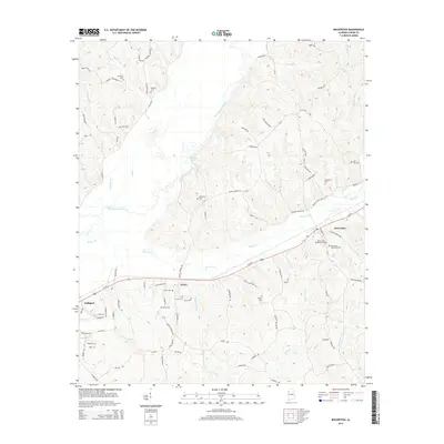
2014 Map of Beaverton
USGS Topo · Published 2014About this map
The Buttahatchee River meanders through the heart of this landscape, anchoring a rural topography defined by the small settlements of Beaverton, Crews, and the eastern outskirts of Sulligent. This 2014 survey reveals a territory where local life is tied to the creek bottoms and rising ridges, with the Beaver Creek and Crews Mill Branch networks drainage toward the river. Historically significant road corridors like the Military Road and Dinky Line Road underscore the long-standing transportation patterns of Lamar County. For those researching family heritage, the map is remarkably dense with burial sites, including the Beaverton Memorial Cemetery, Sizemore Memorial Cemetery, and several smaller family or community plots like Stanford Cemetery and Pope Cemetery. The concentration of these cemeteries alongside landmarks like Stuckey Lake and Olive Hill provides a precise spatial record of the area's rural social structure and land ownership.
Find a feature on this map
96 named features on this map. Tap any name to fly to it.
Don’t see what you’re looking for? This feature index may not catch every label — zoom into the map to look around manually.
Map Details
Editions of this 2014 Beaverton Map
This is the sole edition of this map. No revisions or reprints were ever made.
Other maps of this area

1953 · Birmingham
USGS Topo · 1:250,000

1953 · West Point
USGS Topo · 1:250,000

1956 · Birmingham
USGS Topo · 1:250,000

1956 · Gadsden
USGS Topo · 1:250,000

1956 · Tupelo
USGS Topo · 1:250,000

1957 · Birmingham
USGS Topo · 1:250,000

1958 · Tupelo
USGS Topo · 1:250,000

1958 · West Point
USGS Topo · 1:250,000

1958 · Gadsden
USGS Topo · 1:250,000

1960 · Gadsden
USGS Topo · 1:250,000