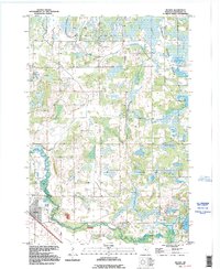
1991 Map of Becker
USGS Topo · Published 1995About this map
The Elk River winds across the southern portion of this landscape, anchoring the settlement of Becker during a period of modern revision and environmental preservation. The northeastern quadrant is dominated by the Sherburne National Wildlife Refuge, where complex water systems like Durgin Slough, Johnson Slough, and Mud Lake create a distinct marshland character. This area contrasts with the more developed southern corridor, where the town of Becker sits between the river and several local Gravel Pits. Genealogists and local historians will find value in the placement of the Danish Cem and other cemeteries throughout the townships of Santiago and Big Lake. The terrain is further defined by the Snake River and prominent elevations such as Blue Hill, illustrating the glacial topography of Sherburne County before late-century expansion.
Find a feature on this map
21 named features on this map. Tap any name to fly to it.
Don’t see what you’re looking for? This feature index may not catch every label — zoom into the map to look around manually.
Map Details
Editions of this 1991 Becker Map
This is the sole edition of this map. No revisions or reprints were ever made.
Other maps of this area

1953 · Stillwater
USGS Topo · 1:250,000

1955 · Stillwater
USGS Topo · 1:250,000

1958 · Stillwater
USGS Topo · 1:250,000

1961 · Clear Lake
USGS Topo · 1:24,000

1961 · Big Lake
USGS Topo · 1:24,000

1961 · Silver Creek
USGS Topo · 1:24,000

1961 · Orrock
USGS Topo · 1:24,000

1961 · Monticello
USGS Topo · 1:24,000

1961 · Becker
USGS Topo · 1:24,000

1961 · Monticello
USGS Topo · 1:62,500