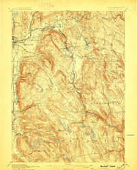
1897 Map of Becket
USGS Topo · Published 1897About this map
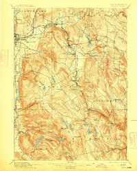
The rugged highlands of the Berkshires are captured here in the late 19th century, dominated by the winding course of the Housatonic River and the critical rail arteries of the Boston and Albany Railroad. This network defines the industrial and residential clusters of the era, from the manufacturing center at Lenox Furnace to the remote highland village of Washington. The landscape is a complex system of water management, visible in the numerous reservoirs and ponds like Plunkett Reservoir and Ashley Lake that served the growing urban needs of Pittsfield.
Find a feature on this map
72 named features on this map. Tap any name to fly to it.
Don’t see what you’re looking for? This feature index may not catch every label — zoom into the map to look around manually.
Map Details
Editions of this 1897 Becket Map
8 editions found
Other maps of this area

1885 · Sheffield
USGS Topo · 1:62,500

1886 · Greylock
USGS Topo · 1:62,500

1886 · Hawley
USGS Topo · 1:62,500

1886 · Chesterfield
USGS Topo · 1:62,500

1886 · Becket
USGS Topo · 1:62,500

1887 · Granville
USGS Topo · 1:62,500

1888 · Sheffield
USGS Topo · 1:62,500

1888 · Becket
USGS Topo · 1:62,500

1888 · Berlin
USGS Topo · 1:62,500

1888 · Sandisfield
USGS Topo · 1:62,500