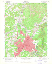
1969 Map of Beckley
USGS Topo · Published 1973About this map
The growing city of Beckley anchors this 1969 survey, showing the urban expansion of the southern West Virginia coalfields during the late sixties. The map documents a complex landscape where residential development in Sprague and East Beckley meets industrial operations, evidenced by several Strip Mine sites and Industrial Waste Ponds to the north and east. The city's role as a regional service hub is clear through the presence of institutions like Beckley College, the VA Hospital, and the Pinecrest Sanitarium.
Find a feature on this map
93 named features on this map. Tap any name to fly to it.
Don’t see what you’re looking for? This feature index may not catch every label — zoom into the map to look around manually.
Map Details
Editions of this 1969 Beckley Map
Other maps of this area

1891 · Raleigh
USGS Topo · 1:125,000

1897 · Raleigh
USGS Topo · 1:125,000

1902 · Raleigh
USGS Topo · 1:125,000

1911 · Marshes
USGS Topo · 1:48,000

1911 · Flattop
USGS Topo · 1:48,000

1911 · Beckley
USGS Topo · 1:48,000

1912 · Mullens
USGS Topo · 1:62,500

1913 · Beckley
USGS Topo · 1:62,500

1914 · Eccles
USGS Topo · 1:62,500

1914 · Flattop
USGS Topo · 1:62,500