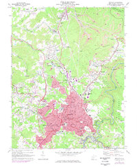
1969 Map of Beckley
USGS Topo · Published 1977About this map
Beckley and its surrounding communities are documented here during a period of significant mid-century growth and industrial activity. The landscape is defined by the extraction economy of the West Virginia coalfields, with numerous Strip Mines and industrial sites like the Chesapeake and Ohio railroad network connecting towns from Mabscott to Piney View. This survey captures the urban footprint of the city before major later expansions, showing established neighborhoods, the VA Hospital, and several academic institutions including Wilson High Sch and Beckley Sch.
Find a feature on this map
83 named features on this map. Tap any name to fly to it.
Don’t see what you’re looking for? This feature index may not catch every label — zoom into the map to look around manually.
Map Details
Editions of this 1969 Beckley Map
Other maps of this area

1891 · Raleigh
USGS Topo · 1:125,000

1897 · Raleigh
USGS Topo · 1:125,000

1902 · Raleigh
USGS Topo · 1:125,000

1911 · Marshes
USGS Topo · 1:48,000

1911 · Flattop
USGS Topo · 1:48,000

1911 · Beckley
USGS Topo · 1:48,000

1912 · Mullens
USGS Topo · 1:62,500

1913 · Beckley
USGS Topo · 1:62,500

1914 · Eccles
USGS Topo · 1:62,500

1914 · Flattop
USGS Topo · 1:62,500