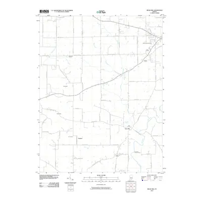
2010 Map of Becks Mill
USGS Topo · Published 2010About this map
The Blue River carves through this rural landscape in Washington County, defining the agricultural and industrial history of the region. At the heart of the map lies the settlement of Becks Mill, named for the gristmill that served as a central hub for early pioneers. This area is particularly rich for genealogical research, featuring several family-named burial grounds such as the Smith-Miller Pioneer Cemetery, Mount Tabor Cemetery, and Coggswell Cemetery. The terrain is marked by significant elevations like Pikes Peak and Smith Hill, while the local economy is illustrated by modern landmarks such as the Salem Speedway and Salem Municipal Airport. The distribution of scattered settlements like Rosebud and institutional sites like Kansas Church reflects a pattern of rural development that has persisted for generations.
Find a feature on this map
63 named features on this map. Tap any name to fly to it.
Don’t see what you’re looking for? This feature index may not catch every label — zoom into the map to look around manually.
Map Details
Editions of this 2010 Becks Mill Map
This is the sole edition of this map. No revisions or reprints were ever made.
Other maps of this area

1947 · Hardinsburg
USGS Topo · 1:24,000

1949 · Hardinsburg
USGS Topo · 1:24,000

1950 · Salem
USGS Topo · 1:24,000

1950 · Becks Mill
USGS Topo · 1:24,000

1950 · Palmyra
USGS Topo · 1:24,000

1951 · Smedley
USGS Topo · 1:24,000

1953 · Fredericksburg
USGS Topo · 1:24,000

1953 · Kossuth
USGS Topo · 1:24,000

1956 · Vincennes
USGS Topo · 1:250,000

1957 · Vincennes
USGS Topo · 1:250,000