
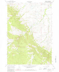
1964 Map of Beckton
USGS Topo · Published 1968About this map
Beckton serves as the primary settlement on this Sheridan County landscape, situated near the confluence of Spring Creek and Goose Creek. The northern half of the map reveals a transition from these low-lying watercourses toward the dramatic ascent of the Bighorn National Forest. This transition is marked by the presence of the Sheridan Filtration Plant and a Gaging Sta along Big Goose Creek, signifying the importance of water management to the nearby city.
Find a feature on this map
72 named features on this map. Tap any name to fly to it.
Don’t see what you’re looking for? This feature index may not catch every label — zoom into the map to look around manually.
Map Details
Editions of this 1964 Beckton Map
2 editions found
Other maps of this area

1895 · Dayton
USGS Topo · 1:125,000

1901 · Dayton
USGS Topo · 1:125,000

1955 · Sheridan
USGS Topo · 1:250,000

1958 · Sheridan
USGS Topo · 1:250,000

1962 · Sheridan
USGS Topo · 1:250,000

1964 · Wolf
USGS Topo · 1:24,000

1964 · Dayton South
USGS Topo · 1:24,000

1964 · Walker Mountain
USGS Topo · 1:24,000
1964 · Dome Lake
USGS Topo · 1:24,000
1964 · Hultz Draw
USGS Topo · 1:24,000