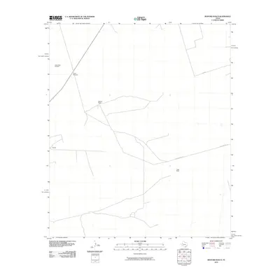
2010 Map of Bedford Ranch
USGS Topo · Published 2010About this map
The sprawling cattle country of Ector County is defined here by its legacy of ranching operations and water management. Isolated landmarks such as the Green Gate Windmill and North Windmill underscore the necessity of groundwater in this arid West Texas landscape. Large-scale land holdings are anchored by Bedford Ranch and Flagg Ranch, which serve as the primary hubs for regional activity. The transportation network is sparse, characterized by functional routes like Sheep Pasture Rd and Sw 7000 that connect the remote outposts. Further west, the V Ranch marks another point of settlement in a terrain otherwise dedicated to livestock and the infrastructure required to sustain them.
Find a feature on this map
7 named features on this map. Tap any name to fly to it.
Don’t see what you’re looking for? This feature index may not catch every label — zoom into the map to look around manually.
Map Details
Editions of this 2010 Bedford Ranch Map
This is the sole edition of this map. No revisions or reprints were ever made.
Other maps of this area

1954 · Hobbs
USGS Topo · 1:250,000

1954 · Pecos
USGS Topo · 1:250,000

1957 · Pecos
USGS Topo · 1:250,000

1958 · Hobbs
USGS Topo · 1:250,000

1964 · Turnbaugh Corner
USGS Topo · 1:24,000

1968 · Coyote Corner
USGS Topo · 1:24,000

1968 · North Cowden NW
USGS Topo · 1:24,000

1971 · Notrees
USGS Topo · 1:24,000

1971 · Notrees NW
USGS Topo · 1:24,000

1971 · Figure Seven Ranch
USGS Topo · 1:24,000