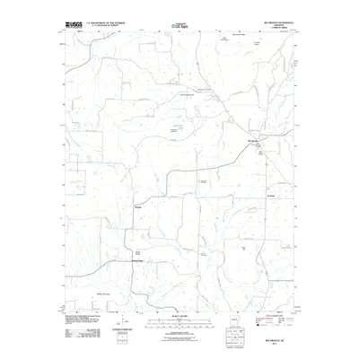
2011 Map of Bee Branch
USGS Topo · Published 2011About this map
Bee Branch serves as a central hub in this Van Buren County landscape, where the Bee Branch Post Office and Bee Branch Cemetery mark the heart of the settlement. The area's topography is defined by significant elevations like Harmony Mountain and Roberts Mountain, which overlook a network of watercourses including Cove Creek and the notably named Kill Dead Creek. Local history is preserved in several family and community burial grounds, such as Quattlebaum Cemetery, Blackwell Cemetery, and Lloyd Cemetery, scattered among the rural routes. Smaller settlements like Whipple, Southside, and Rabbit Ridge dot the countryside, connected by a intricate web of county roads. The map also records localized industry and infrastructure, evidenced by the B B Ranch Lake Dam and various ridges that shaped the movement and settlement patterns of this Arkansas region.
Find a feature on this map
76 named features on this map. Tap any name to fly to it.
Don’t see what you’re looking for? This feature index may not catch every label — zoom into the map to look around manually.
Map Details
Editions of this 2011 Bee Branch Map
This is the sole edition of this map. No revisions or reprints were ever made.
Other maps of this area

1892 · Marshall
USGS Topo · 1:125,000

1892 · Mountain View
USGS Topo · 1:125,000

1892 · Morrillton
USGS Topo · 1:125,000

1894 · Mountain View
USGS Topo · 1:125,000

1894 · Morrillton
USGS Topo · 1:125,000

1894 · Marshall
USGS Topo · 1:125,000

1901 · Marshall
USGS Topo · 1:125,000

1956 · Russellville
USGS Topo · 1:250,000

1961 · Bee Branch
USGS Topo · 1:62,500

1961 · Bee Branch
USGS Topo · 1:24,000