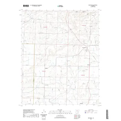
2020 Map of Bee Branch
USGS Topo · Published 2020About this map
Bee Branch serves as a central hub in this high-elevation pocket of the Ozark foothills, situated where the terrain transitions toward the Conway County line. The landscape is defined by its numerous family-named peaks and hollows, including Hunter Mtn, Harmony Mtn, and the curiously named Wolf Fall Hollow. This 2020 record illustrates the enduring rural settlement pattern of the region, where communities like Rabbit Ridge, Whipple, and Southside are connected by a network of winding county roads such as Gravesville Cutoff Rd and Round Spring Rd.
Find a feature on this map
95 named features on this map. Tap any name to fly to it.
Don’t see what you’re looking for? This feature index may not catch every label — zoom into the map to look around manually.
Map Details
Editions of this 2020 Bee Branch Map
This is the sole edition of this map. No revisions or reprints were ever made.
Other maps of this area

1892 · Marshall
USGS Topo · 1:125,000

1892 · Mountain View
USGS Topo · 1:125,000

1892 · Morrillton
USGS Topo · 1:125,000

1894 · Mountain View
USGS Topo · 1:125,000

1894 · Morrillton
USGS Topo · 1:125,000

1894 · Marshall
USGS Topo · 1:125,000

1901 · Marshall
USGS Topo · 1:125,000

1956 · Russellville
USGS Topo · 1:250,000

1961 · Bee Branch
USGS Topo · 1:62,500

1961 · Bee Branch
USGS Topo · 1:24,000