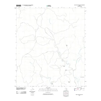
2010 Map of Bee Cave Hollow
USGS Topo · Published 2010About this map
Prade Ranch and Hillcrest Ranch anchor this West Texas landscape, where the headwaters of the West Frio River carve deep into the plateau. The map reveals a complex network of springs and drainages, including Big Springs, Mingus Spring, and Miller Springs, which have historically dictated settlement and ranching boundaries in this arid terrain.
Find a feature on this map
28 named features on this map. Tap any name to fly to it.
Don’t see what you’re looking for? This feature index may not catch every label — zoom into the map to look around manually.
Map Details
Editions of this 2010 Bee Cave Hollow Map
This is the sole edition of this map. No revisions or reprints were ever made.
Other maps of this area

1954 · Llano
USGS Topo · 1:250,000

1954 · San Antonio
USGS Topo · 1:250,000

1955 · Llano
USGS Topo · 1:250,000

1956 · Llano
USGS Topo · 1:250,000

1957 · San Antonio
USGS Topo · 1:250,000

1963 · Garven Store
USGS Topo · 1:24,000

1964 · Hillcrest Ranch
USGS Topo · 1:24,000

1964 · Circle Bluff
USGS Topo · 1:24,000
1971 · Earwood Creek
USGS Topo · 1:24,000
1971 · Owl Hollow
USGS Topo · 1:24,000