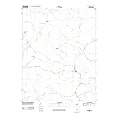
2010 Map of Bee Spring
USGS Topo · Published 2010About this map
Bee Spring and the surrounding Edmonson County countryside are depicted here in a landscape defined by deeply carved drainages and small upland communities. The map highlights a network of local roads tied to community landmarks, such as Miesel Cemetery Rd, New Salem Church Rd, and Duvall Cemetery Rd, which point to the area's genealogical depth. In the southeastern corner, the settlement of Kyrock sits near the Nolin River, while Sweeden and Woodside anchor the southern plateau above Beaverdam Creek.
Find a feature on this map
68 named features on this map. Tap any name to fly to it.
Don’t see what you’re looking for? This feature index may not catch every label — zoom into the map to look around manually.
Map Details
Editions of this 2010 Bee Spring Map
This is the sole edition of this map. No revisions or reprints were ever made.
Other maps of this area

1922 · Leitchfield
USGS Topo · 1:48,000

1922 · Brownsville
USGS Topo · 1:62,500

1922 · Mammoth Cave
USGS Topo · 1:62,500

1923 · Mammoth Cave
USGS Topo · 1:62,500

1923 · Brownsville
USGS Topo · 1:62,500

1925 · Cub Run
USGS Topo · 1:62,500

1925 · Leitchfield
USGS Topo · 1:62,500

1953 · Ready
USGS Topo · 1:24,000

1953 · Bee Spring
USGS Topo · 1:24,000

1954 · Evansville
USGS Topo · 1:250,000