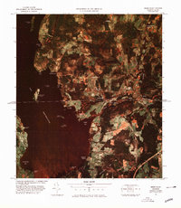
1978 Map of Beebe Plain Station
USGS Topo · Published 1978About this map
The international boundary between Canada and the United States bisects this 1970s orthophoto quadrangle, cutting directly through the dual border community of Beebe. This unique layout is highlighted by the presence of Beebe Plain Station U S Customs and Beebe Canadian Customs, situated at the heart of the settlement. To the west, the deep waters of Lake Memphremagog dominate the landscape, reaching into the shorelines of Holbrook Bay and Derby Bay. The map captures the agricultural and industrial infrastructure of the late 1970s, from the rail lines of the Quebec Central to the operations at Comestock Mills. Smaller clusters like Glyne Corners and Lineboro dot the road network, while the rugged geography is defined by prominent features such as Darling Hill and Shattuck Hill.
Find a feature on this map
37 named features on this map. Tap any name to fly to it.
Don’t see what you’re looking for? This feature index may not catch every label — zoom into the map to look around manually.
Map Details
Editions of this 1978 Beebe Plain Station Map
This is the sole edition of this map. No revisions or reprints were ever made.
Other maps of this area

1919 · Lake Memphremagog
USGS Topo · 1:62,500

1920 · Derby
USGS Topo · 1:62,500

1920 · Irasburg
USGS Topo · 1:62,500

1923 · Irasburg
USGS Topo · 1:48,000

1923 · Lake Memphremagog
USGS Topo · 1:48,000

1925 · Irasburg
USGS Topo · 1:62,500

1925 · Memphremagog
USGS Topo · 1:62,500

1950 · Lake Champlain
USGS Topo · 1:250,000

1953 · Irasburg
USGS Topo · 1:62,500
1953 · Memphremagog
USGS Topo · 1:62,500