
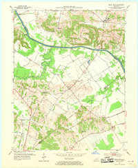
1952 Map of Beech Grove
USGS Topo · Published 1954About this map
The Green River carves a winding path across this landscape, defining the early commerce of McLean and Webster counties. River-dependent commerce is evident through historic access points such as Steamboat Landing and Roland Landing, alongside the established river town of Wrightsburg. South of the river, the terrain transitions into a patchwork of rural homesteads and church-centered communities. Genealogists can find numerous family and community sites, including Sassafras Grove Ch and New Salem Ch, as well as Onton Cem and Mt Zion Cem. The southwestern corner is influenced by the Louisville and Nashville railroad corridor near Elmwood, while the interior is marked by scattered Oil Wells and the small settlement of Onton. Tributaries like Deer Creek and Pitman Creek drain the surrounding hills, illustrating the natural drainage patterns that shaped the region's agricultural development.
Find a feature on this map
23 named features on this map. Tap any name to fly to it.
Don’t see what you’re looking for? This feature index may not catch every label — zoom into the map to look around manually.
Map Details
Editions of this 1952 Beech Grove Map
2 editions found
Other maps of this area

1906 · Sebree
USGS Topo · 1:62,500

1907 · Earlington
USGS Topo · 1:48,000

1908 · Calhoun
USGS Topo · 1:62,500

1909 · Earlington
USGS Topo · 1:62,500

1909 · Madisonville
USGS Topo · 1:62,500

1949 · Sebree
USGS Topo · 1:24,000

1949 · Robards
USGS Topo · 1:24,000

1951 · Sebree
USGS Topo · 1:24,000

1951 · Robards
USGS Topo · 1:24,000

1952 · Sacramento
USGS Topo · 1:24,000