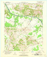
1952 Map of Beech Grove
USGS Topo · Published 1968About this map
The Green River carves a deep path through the Western Kentucky landscape, serving as the central artery for transport and commerce in the early 1950s. This survey records a river-dependent economy evidenced by Steamboat Landing, Roland Landing, and the Eastwood Ferry near the northwestern corner. The terrain transitions from the low-lying river bottoms to dissected uplands where small agricultural communities and churches like Sassafras Grove Ch and New Salem Ch are established.
Find a feature on this map
28 named features on this map. Tap any name to fly to it.
Don’t see what you’re looking for? This feature index may not catch every label — zoom into the map to look around manually.
Map Details
Editions of this 1952 Beech Grove Map
2 editions found

Other maps of this area

1906 · Sebree
USGS Topo · 1:62,500

1907 · Earlington
USGS Topo · 1:48,000

1908 · Calhoun
USGS Topo · 1:62,500

1909 · Earlington
USGS Topo · 1:62,500

1909 · Madisonville
USGS Topo · 1:62,500

1949 · Sebree
USGS Topo · 1:24,000

1949 · Robards
USGS Topo · 1:24,000

1951 · Sebree
USGS Topo · 1:24,000

1951 · Robards
USGS Topo · 1:24,000

1952 · Sacramento
USGS Topo · 1:24,000