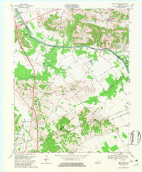
1969 Map of Beech Grove
USGS Topo · Published 1981About this map
The Green River carves a serpentine path through this landscape, marking the historical boundaries between McLean and Webster counties. In the late 1960s, the region was defined by a transition from river-based transportation to modern highway infrastructure, most notably the north-south sweep of the Pennyrile Parkway. Despite the rise of new roads, older landmarks like Steamboat Landing and Roland Landing persist along the riverbank, alongside the Gresham Bridge (Toll) and its adjacent Tollgate. Small settlements such as Beech Grove and Onton serve as local hubs, surrounded by numerous Oil Wells that indicate the area's subterranean resource economy. For genealogists, the map is particularly useful for locating family-named roads like Nance Road and Carver Road, alongside rural burial grounds such as the Mt Zion Cem & Ch and Samuels Cem.
Find a feature on this map
51 named features on this map. Tap any name to fly to it.
Don’t see what you’re looking for? This feature index may not catch every label — zoom into the map to look around manually.
Map Details
Editions of this 1969 Beech Grove Map
2 editions found
Other maps of this area

1906 · Sebree
USGS Topo · 1:62,500

1907 · Earlington
USGS Topo · 1:48,000

1908 · Calhoun
USGS Topo · 1:62,500

1909 · Earlington
USGS Topo · 1:62,500

1909 · Madisonville
USGS Topo · 1:62,500

1949 · Sebree
USGS Topo · 1:24,000

1949 · Robards
USGS Topo · 1:24,000

1951 · Sebree
USGS Topo · 1:24,000

1951 · Robards
USGS Topo · 1:24,000

1952 · Sacramento
USGS Topo · 1:24,000